Skip to content

Home

About Us

Contact Us

  • Facebook
  • X
  • Instagram
  • Pinterest
  • WhatsApp
  • RSS Feed
  • TikTok

Seven Lakes News

Your Trusted Voice Across the World.

Search

More Overnight Storms Renew Flash Flood Risk From Chicago to Toledo With One to Three Inches of Additional Rain Possible by Tomorrow Afternoon

Justin Lyle Avatar
Justin Lyle
August 16, 2026
More Overnight Storms Renew Flash Flood Risk From Chicago to Toledo With One to Three Inches of Additional Rain Possible by Tomorrow Afternoon

INDIANA — More rain is expected overnight tonight into tomorrow over the same areas that have already seen repeated rounds this week, with some areas possibly seeing an additional 1 to 3 inches of rain by tomorrow afternoon. Some storms may produce strong to damaging winds, though the renewed flooding risk remains the primary concern at this time.

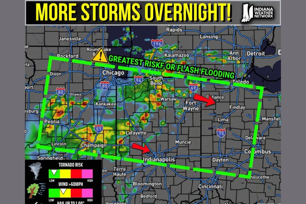
Greatest Flash Flood Risk Corridor Stretches From Rockford to Toledo

The area of greatest risk for flash flooding is outlined in a broad corridor stretching from near Rockford and Chicago through South Bend, Fort Wayne, and Toledo. This zone represents where forecasters have the highest confidence in significant flooding impacts from the overnight and morning rainfall.

Radar shows widespread heavy rain already covering much of this corridor, with the most intense returns concentrated near Peoria, Kankakee, and stretching through central Indiana toward Fort Wayne as the system continues developing.

One to Three Inches of Additional Rain Possible by Afternoon

Some areas within the highlighted corridor may see an additional 1 to 3 inches of rain by tomorrow afternoon, adding to already saturated ground from the repeated rounds of storms that have affected the region throughout the week.

This additional rainfall total raises significant concern for continued flash flooding, particularly in communities that have already experienced multiple rounds of heavy rain and may have limited capacity to absorb further precipitation.

Strong to Damaging Winds Possible Though Flooding Remains Top Concern

While some storms may produce strong to damaging winds as they move through the corridor overnight, forecasters emphasized that the renewed flooding risk remains the primary concern at this time compared to other potential severe weather hazards.

The risk category graphic shows flash flood risk elevated toward the higher end of the scale, while tornado risk, wind over 60 mph, and hail up to 1 inch all remain at lower levels, reinforcing that flooding is the dominant hazard for this event.

Break From Rain Expected Early Next Week

Despite the continued overnight and morning threat, forecasters do look to have a break from the rain early this upcoming week, offering some relief on the horizon following what has been an extended stretch of active weather across Indiana and surrounding areas.

Residents throughout the corridor from Chicago through South Bend, Fort Wayne, and Toledo are urged to stay weather aware overnight and avoid flooded roadways as this latest round of heavy rain moves through before the anticipated drier pattern arrives next week.
Leave a Reply Cancel reply

Your email address will not be published. Required fields are marked *

Featured Articles

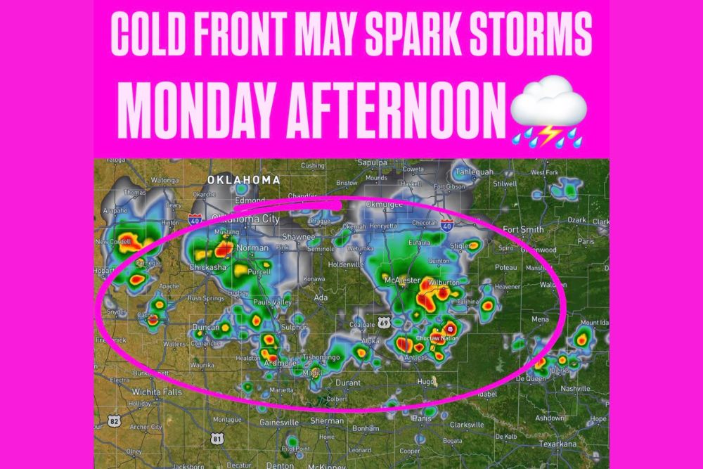
  • Weak Cold Front Sparks Isolated Storms Sunday Across Central Oklahoma Before Pushing South to Red River Monday Afternoon

    Weak Cold Front Sparks Isolated Storms Sunday Across Central Oklahoma Before Pushing South to Red River Monday Afternoon

    August 16, 2026
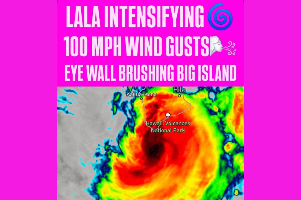
  • Hurricane Lala Intensifies With Eighty MPH Sustained Winds and Gusts Reaching One Hundred MPH as Eye Wall Brushes Southern Big Island

    Hurricane Lala Intensifies With Eighty MPH Sustained Winds and Gusts Reaching One Hundred MPH as Eye Wall Brushes Southern Big Island

    August 16, 2026
  • NASA Confirms Fireball Over Washington State Fragmented With Force of Ten Tons of TNT After Traveling Thirty Six Miles Through Upper Atmosphere

    NASA Confirms Fireball Over Washington State Fragmented With Force of Ten Tons of TNT After Traveling Thirty Six Miles Through Upper Atmosphere

    August 16, 2026
  • Tornado Warning Issued for Columbus as Radar Indicates Strong Rotation With Storm Moving East at Twenty Five MPH Toward Reynoldsburg

    Tornado Warning Issued for Columbus as Radar Indicates Strong Rotation With Storm Moving East at Twenty Five MPH Toward Reynoldsburg

    August 16, 2026
  • Reevas Basin Fire Grows to Four Hundred Acres East of Tonasket Washington With Fast Growing Smoke Column and Multiple Aircraft Responding

    Reevas Basin Fire Grows to Four Hundred Acres East of Tonasket Washington With Fast Growing Smoke Column and Multiple Aircraft Responding

    August 16, 2026

Search

Follow Us on

  • Facebook
  • X
  • Instagram
  • VK
  • Pinterest
  • Last.fm
  • TikTok
  • Telegram
  • WhatsApp
  • RSS Feed

Categories

  • Climate Forecast (47)

About Seven Lakes News

We cover the weather that changes your day: storm warnings, heat and cold advisories, flooding, snow, and the forecasts behind them. We are not the National Weather Service and we do not issue warnings. When severe weather is close, check weather.gov or your local NWS office before you act on anything you read here.

Latest Articles

  • Weak Cold Front Sparks Isolated Storms Sunday Across Central Oklahoma Before Pushing South to Red River Monday Afternoon

    Weak Cold Front Sparks Isolated Storms Sunday Across Central Oklahoma Before Pushing South to Red River Monday Afternoon

    August 16, 2026
  • Hurricane Lala Intensifies With Eighty MPH Sustained Winds and Gusts Reaching One Hundred MPH as Eye Wall Brushes Southern Big Island

    Hurricane Lala Intensifies With Eighty MPH Sustained Winds and Gusts Reaching One Hundred MPH as Eye Wall Brushes Southern Big Island

    August 16, 2026
  • NASA Confirms Fireball Over Washington State Fragmented With Force of Ten Tons of TNT After Traveling Thirty Six Miles Through Upper Atmosphere

    NASA Confirms Fireball Over Washington State Fragmented With Force of Ten Tons of TNT After Traveling Thirty Six Miles Through Upper Atmosphere

    August 16, 2026

Categories

  • Climate Forecast (47)
August 2026
M T W T F S S
 12
3456789
10111213141516
17181920212223
24252627282930
31  
     

© 2026 Seven Lakes News | All Rights Reserved.

Scroll to Top