
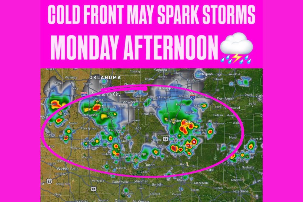
OKLAHOMA — A weak cold front will move into northern Oklahoma on Sunday, sparking isolated storms from the Oklahoma and Kansas border to Interstate 40 in central Oklahoma Sunday afternoon. The weak boundary, possibly reinforced by thunderstorm outflow winds, may push south into southern Oklahoma, triggering additional isolated storms Monday afternoon down to the Red River.
Sunday Storms Target Corridor From Border to Interstate 40
Sunday’s isolated storm activity is expected to develop along a corridor stretching from the Oklahoma and Kansas border south through the Oklahoma City metro and down to Interstate 40. Communities including Norman, Chickasha, and Shawnee fall within this initial zone of concern as the cold front first moves into the state.
This Sunday afternoon timing places the storm development during typical peak heating hours, when the incoming boundary is most likely to interact with daytime instability to spark isolated convection across central Oklahoma.
Outflow Winds Could Push Boundary Further South Overnight
The weak boundary may be reinforced by thunderstorm outflow winds generated from Sunday’s activity, potentially pushing the front farther south into southern Oklahoma overnight. This outflow-driven progression would extend the boundary’s reach beyond its initial Sunday position.
This mechanism, where storm-generated outflow effectively nudges a weak front forward, is a common way boundaries can advance farther than their original forecast track would suggest, setting up the potential for continued storm activity into Monday.
Monday Activity Could Extend Storms Down to the Red River
If the boundary does push south as expected, additional isolated storms are possible Monday afternoon extending down to the Red River, the boundary separating Oklahoma from Texas. This would bring the storm potential to a much broader stretch of the state compared to Sunday’s more localized activity.
Communities including Ardmore, Durant, and Marietta, all positioned near the Red River corridor, would fall within the zone most likely to see Monday’s storm activity should the front continue its southward progression.
Current Radar Shows Storms Already Active Across Eastern Oklahoma
Radar imagery shows storms already active across a broad stretch of eastern and central Oklahoma, including areas near McAlester, Wilburton, and Antlers, with additional activity near Duncan and Ardmore. This existing activity reflects the atmosphere’s current capacity for storm development ahead of the incoming front.
Residents across Oklahoma, from the Kansas border through the Red River, are encouraged to monitor the forecast through the weekend as this weak cold front and its potential outflow-driven progression continue to be tracked into early next week.
Leave a Reply