
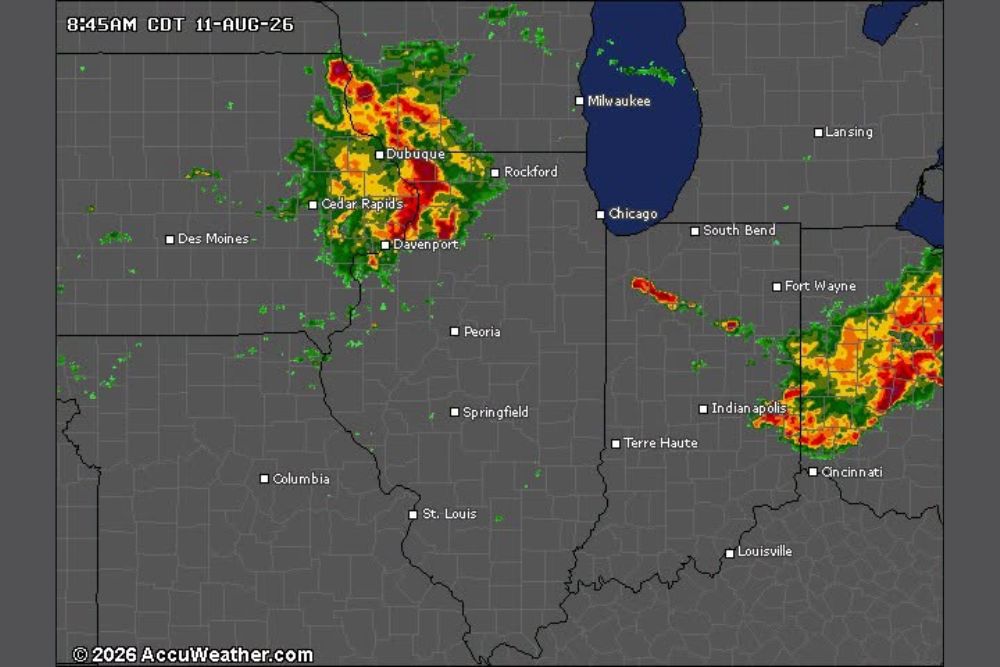
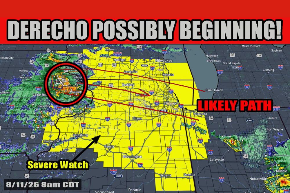
ILLINOIS — A large area of storms known as a Mesoscale Convective Complex is moving out of Iowa and into northwest Illinois, prompting a Severe Thunderstorm Watch across the region. This cluster of storms is currently moving east at 50 mph and should continue that movement for a while before turning southeast, meaning the complex itself should stay mostly to the north and northeast of the broader Illinois area.
Severe Thunderstorm Watch 563 Covers Corridor Through Two P.M.
Severe Thunderstorm Watch 563 is valid from 7:20 a.m. until 2 p.m., covering a corridor stretching from Mason City and Waterloo through Dubuque, Rockford, and down through Peoria and toward Lafayette and Champaign. Current radar shows the strongest core of the complex positioned near Dubuque and Cedar Rapids.
The fast eastward movement at 50 mph means this initial round should progress through the watch area relatively quickly, though the complex’s broader influence on the atmosphere is expected to continue well beyond its own passage.
Outflow Boundary Could Spark New Storms This Afternoon
Forecasters will be watching for what is called an outflow boundary to potentially form out of this complex to the south of its movement. An outflow boundary is essentially a small cold front caused by cooler air rushing out of the complex, and these boundaries can trigger new storm development.
If an outflow boundary does form, that will become the primary focus for storms developing by this afternoon, shifting attention away from the original complex and toward newly forming activity along the boundary itself.
Simulated Radar Shows New Storms Developing by Four PM
Forecast radar valid for 4 p.m. Tuesday shows the potential for new storms developing along an outflow boundary, positioned separately from the location of the original storm complex. This simulated guidance illustrates how the boundary mechanism could spark fresh convection later in the day.
By 5 p.m. and 6 p.m., the simulated radar shows this new activity continuing to expand and organize, suggesting the outflow-driven storms could become a more significant feature of the afternoon and evening forecast.
Residents Urged to Stay Weather Aware Through the Afternoon
While the original complex is expected to track mostly north and northeast of the immediate area, the potential for new storm development along an outflow boundary means the overall severe weather picture remains fluid heading into the afternoon.
Residents throughout the watch area, including Rockford, Peoria, and Springfield, are encouraged to stay weather aware today as forecasters continue monitoring how the outflow boundary situation develops through the afternoon hours.
Leave a Reply