
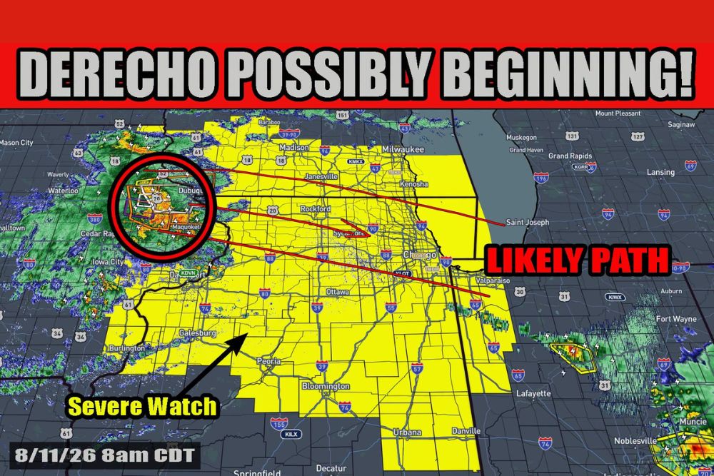
ILLINOIS — A derecho is possibly beginning on schedule Tuesday morning, with 75 mph wind gusts already noted in Independence, Iowa, and an 80 mph report in Farley from this compact but very powerful bow echo. The projected path will bring the system toward the Chicago area, with many severe and tornado warnings already issued as the morning progresses.
Compact Bow Echo Already Producing Damaging Wind Reports
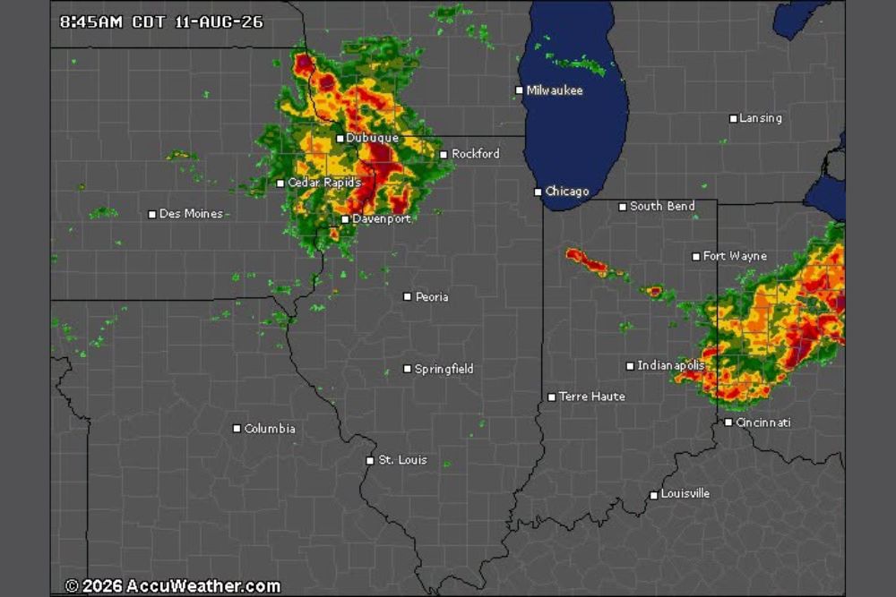
The bow echo responsible for the developing derecho is currently centered near Dubuque, Iowa, with radar showing an intense, well-organized core within a circled area of highest concern. The system has already produced 75 mph gusts in Independence and an 80 mph report in Farley.
Despite its power, forecasters describe the system as compact rather than a broad squall line at this stage, though its intensity has already proven capable of significant wind damage across northeast Iowa.
Sun Building Instability Ahead of System Through Morning
With the sun now up, quick work is expected building instability across the swampy airmass positioned out ahead of the system. This developing instability should allow for at least maintenance of the bow echo’s current strength, with possible additional strengthening as the morning progresses.
This daytime heating process is a key factor forecasters are watching, since it directly influences whether the system will hold its current intensity or continue to intensify as it tracks toward more populated areas.
Severe Thunderstorm Watch Covers Corridor Toward Chicago and Indiana
A Severe Thunderstorm Watch spans a broad corridor from Waterloo and Dubuque through Rockford, Chicago, and continuing into Bloomington, Danville, and toward the Indiana state line. The likely path for the bow echo runs directly through Rockford and Chicago before continuing toward Valparaiso and Fort Wayne.
Communities within this watch area, including Peoria, Ottawa, and the greater Chicago metro, should prepare for the possibility of significant wind gusts as the system continues along its projected eastward track.
Uncertainty Remains Over Whether System Expands Into Squall Line
What remains to be seen is whether the system will expand into more of a large squall line or remain a compact bow echo as it continues its journey east. This distinction matters significantly for how widespread the eventual wind damage footprint could become.
Residents across northern Illinois, particularly in and around Chicago, are urged to stay weather aware through the morning as many severe and tornado warnings have already been issued and are expected to continue as the system approaches.
Leave a Reply