
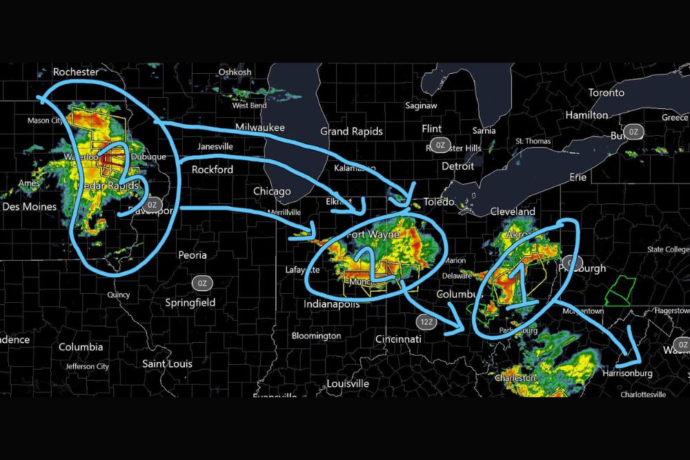
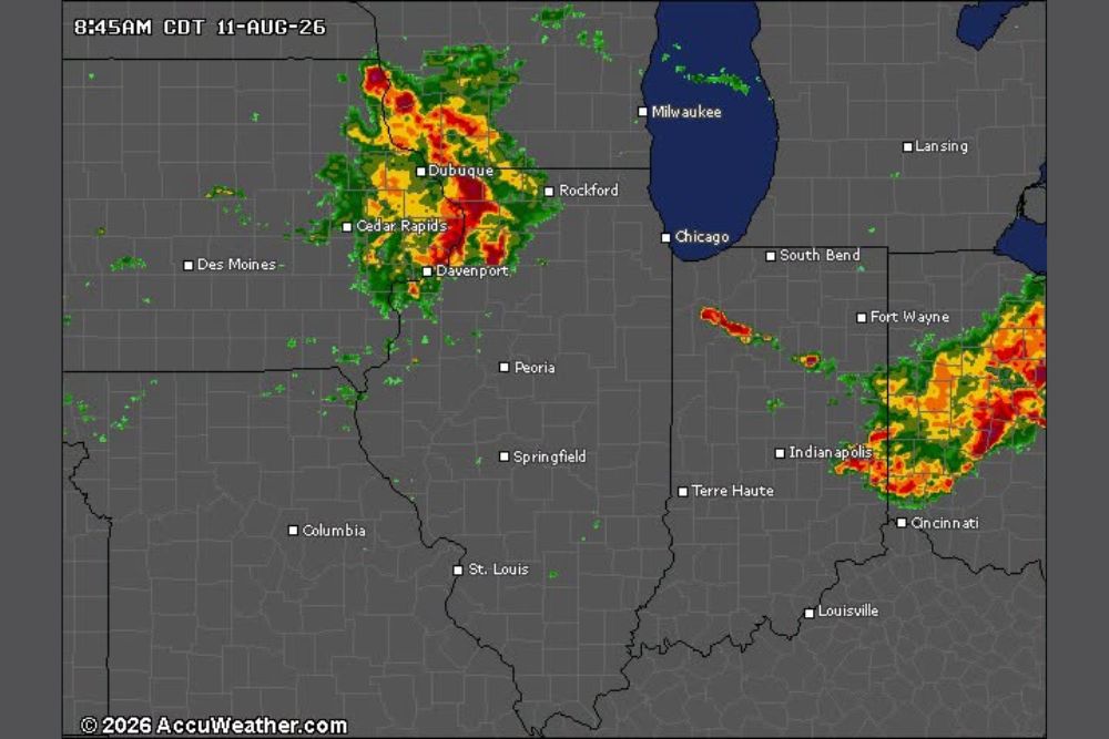
MIDWEST — Forecasters are tracking three separate storm complexes either currently impacting the region or set to arrive shortly, with the setup already producing multiple Tornado Warnings this morning. Observed wind gusts have reached up to 75 mph, with damaging winds of 50 to 70 mph, hail up to ping-pong ball size, and a brief tornado all remaining possible across the affected corridor.
Complex One Clears Iowa and Illinois Within the Next Two Hours
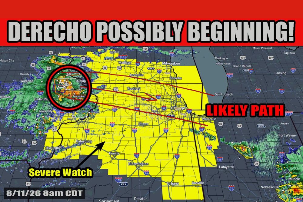
The first storm complex, currently centered near Cedar Rapids, Dubuque, and Waterloo in Iowa, is expected to move out of the immediate region within the next one to two hours. Radar shows this complex still carrying areas of heavier activity as it continues its eastward push.
Communities along its current path, including Rockford and areas approaching the Chicago metro, should watch for continued impacts as this first complex finishes clearing the region over the coming hours.
Complex Two Set to Clear Region Within Next Few Hours
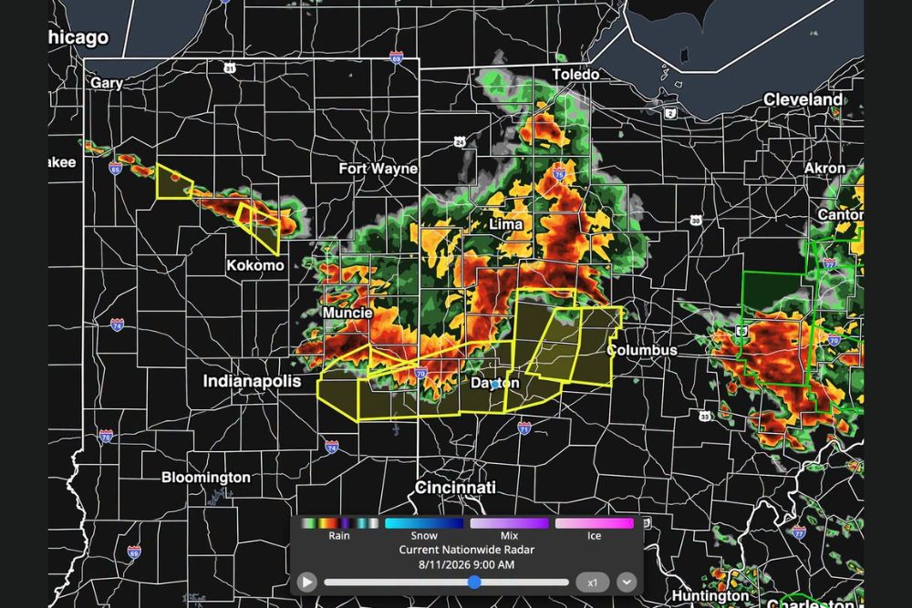
A second complex, tracking near Fort Wayne and continuing toward Columbus and Akron, is expected to clear the broader region within the next few hours. This complex has been part of the setup already responsible for observed wind gusts up to 75 mph this morning.
Areas from Lafayette and Indianapolis through Marion and into Ohio remain in the path of this system as it continues its eastward trajectory before exiting the region.
Complex Three Emerges as Primary Threat Into Tonight
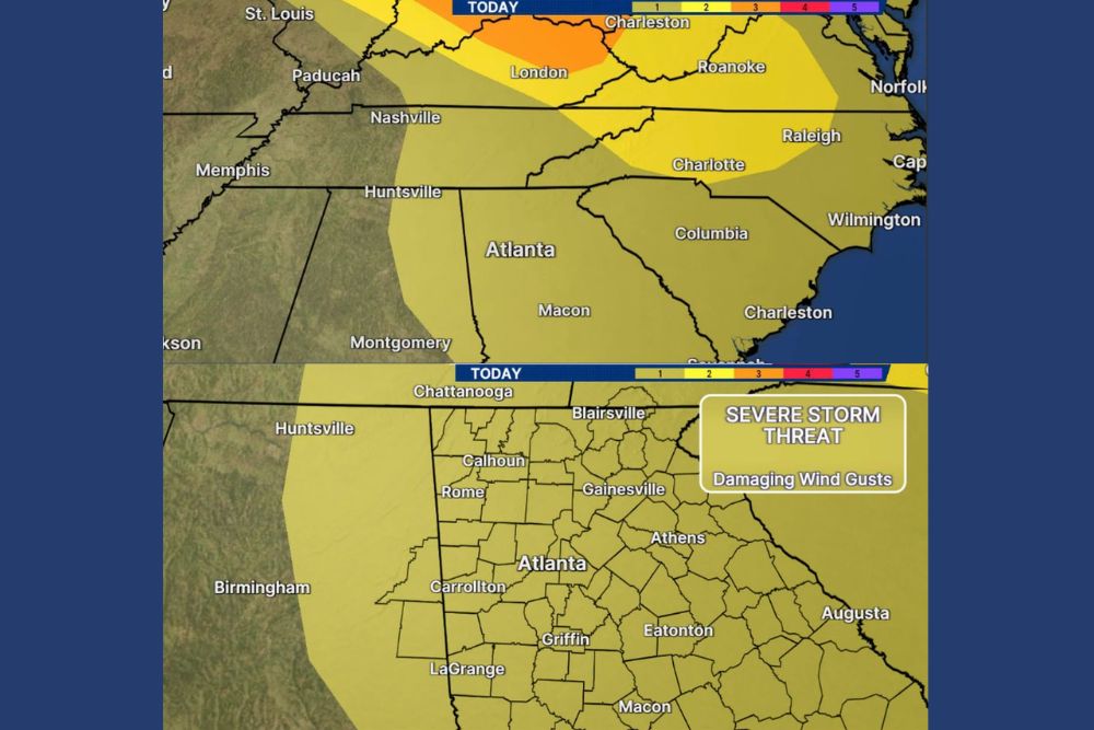
The third complex is the one forecasters are watching most closely, expected to drive widespread damaging to destructive winds later this afternoon into tonight. Exact track for this system remains uncertain, currently positioned near Pittsburgh and tracking toward Harrisburg and Washington D.C.
Communities across the path of this third complex, including Pittsburgh, Morgantown, and Hagerstown, face the greatest risk for the most significant impacts as this system continues developing through the afternoon and evening hours.
Flash Flooding and Large Hail Compound Widespread Wind Threat
Flash flooding is also in play across the region, with 1 to 4 inches of rain possible under the hardest-hit storms from any of the three complexes. Hail up to ping-pong ball size adds another significant hazard to the mix.
Forecasters describe the overall situation as messy and evolving, with each complex influencing the next and storms developing in areas that models did not originally project, underscoring the need for continued close monitoring throughout the day.
Leave a Reply