
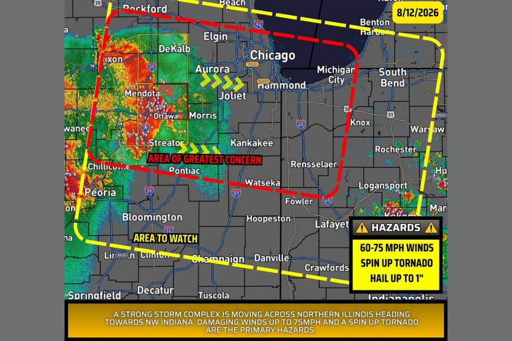
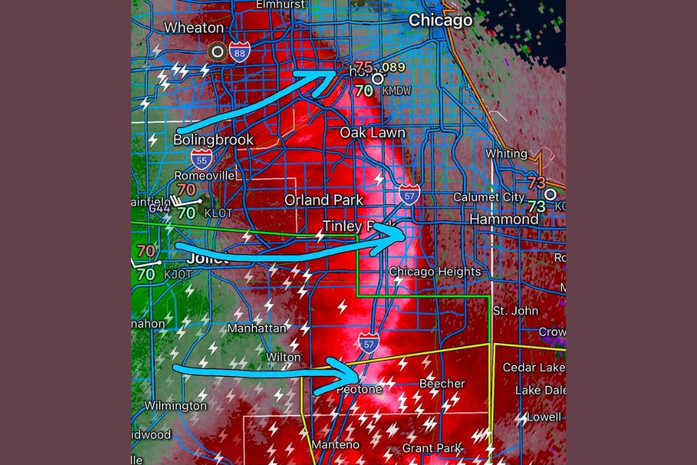
INDIANA — A severe storm complex is currently moving across northern Illinois producing damaging winds of 60 to 70 mph as it heads toward northwest Indiana Tuesday morning. Areas in red carry the greatest confidence of being impacted by this storm complex, with areas in yellow possibly seeing some impacts if the complex holds together as it continues moving east at 45 mph.
Area of Greatest Concern Stretches From Dixon Through Michigan City
The area carrying the greatest confidence for impacts stretches from near Dixon and Mendota through Ottawa, Morris, and Kankakee before continuing toward Michigan City and the Indiana border. Radar shows the most intense core of the complex currently centered over Mendota, Ottawa, and Streator.
Communities within this red-shaded corridor, including Watseka and Rensselaer, should prepare for the highest likelihood of experiencing the complex’s most significant winds as it continues its eastward trajectory at 45 mph.
Broader Watch Area Extends Toward South Bend and Warsaw
A broader yellow-shaded area to watch extends from near Rockford and Beach Michigan through South Bend, Warsaw, and down through Lafayette, Danville, and Champaign. This zone reflects areas that could see impacts should the complex maintain its current strength and organization.
Communities including Knox, Rochester, and Logansport fall within this broader watch corridor, where impacts remain possible but less certain compared to the area of greatest concern positioned farther west.
Spin Up Tornado Risk Accompanies Primary Wind Threat
Beyond the primary damaging wind threat, a spin up tornado remains possible with this complex as it continues moving east. Hail up to 1 inch in diameter rounds out the hazard profile for storms embedded within the broader complex.
Forecasters indicate damaging winds up to 75 mph and the spin up tornado threat represent the primary hazards associated with this system as it continues its push toward northwest Indiana through the late morning hours.
Complex Expected to Continue Moving East at Forty-Five MPH
With the complex moving at a steady 45 mph, communities across the watch area should expect relatively fast-moving conditions once the storms arrive, limiting the duration of impacts at any single location while the system continues its eastward progression.
Residents throughout northwest Indiana, including South Bend, Warsaw, and Lafayette, are encouraged to stay weather aware through the late morning as the complex continues tracking toward the region from northern Illinois.

Leave a Reply