
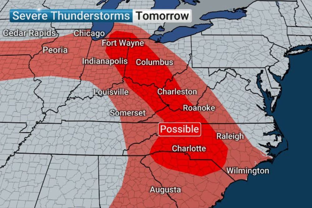
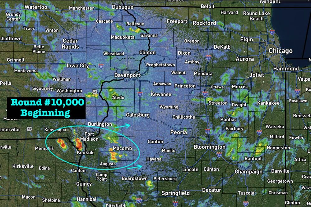
APPALACHIANS — Severe storms and a potential Mesoscale Convective Vortex will form in the Upper Midwest and travel toward the Appalachians on Saturday, marking two days in a row of active weather with no shame in the repeated pattern. High winds are the primary risk, along with flooding rain, as storms continue riding on the northern side of a high pressure ridge parked over the South.
Saturday Severe Corridor Stretches From Fort Wayne to Charlotte
Saturday’s severe thunderstorm threat spans a corridor from near Fort Wayne and Columbus through Charleston, West Virginia, and Roanoke before continuing into Charlotte and toward Raleigh. This band represents where the strongest storms are expected as the system tracks toward the Appalachians.
A separate area of concern for Saturday also stretches across the Plains, including Omaha, Kansas City, and North Platte, reflecting the broader reach of the same pattern responsible for repeated storm development across multiple regions this week.
High Winds Remain Primary Risk as Familiar Pattern Continues
High winds are identified as the primary risk associated with Saturday’s severe storms, along with the potential for flooding rain. This threat profile matches the same pattern that has produced repeated rounds of storms throughout the week, as systems continue riding along the northern edge of the entrenched southern ridge.
Communities from Indianapolis and Louisville through Charlotte and Wilmington should prepare for the possibility of damaging wind gusts as Saturday’s storms move through the corridor stretching from the Midwest into the Appalachians and Carolinas.
Sunday Storms Shift Focus to Ohio Valley With Flash Flooding Concern
On Sunday, storms are expected to form in the Ohio Valley, bringing more wind and rain that may cause urban flash flooding and keep creeks and streams running high. Communities including Indianapolis, Columbus, and Louisville fall within this Sunday threat corridor.
This flooding risk extends into the Chesapeake Bay area into the evening, meaning the wind and rain threat originating in the Ohio Valley is expected to track eastward and continue posing hazards well into Sunday night for communities along the Mid-Atlantic coast.
Colorado and Plains Also Face Sunday Storm Chances
Beyond the Ohio Valley, a separate area of concern for Sunday stretches across the Plains and into Colorado, including Denver, Pueblo, and Cheyenne. This reflects the continued widespread nature of the active pattern extending well beyond the Ohio Valley and Appalachian corridor.
Residents across the Midwest, Ohio Valley, Appalachians, and Carolinas are encouraged to stay weather aware throughout the weekend as this repeating pattern continues bringing multiple days of severe storm potential, high winds, and flooding rain to the region.
Leave a Reply